Projects
Jason-3
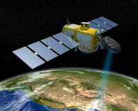
Jason-3 is a follow on to the Ocean Surface Topography Mission on the Jason-2 satellite (OSTM/Jason-2; hereafter referred to as Jason-2) and represents the first truly operational satellite altimeter for oceanography applications. As an international cooperative mission between NASA, CNES, NOAA, and Eumetsat, Jason-3 continued the decades-long measurements of sea surface height begun by Topex/Poseidon (1992}, Jason-1 (2001), and Jason-2 (2008).
To conduct its high-precision altimetry mission, Jason-3 carries the same kind of payload as its predecessors. Payload instruments include a Poseidon-class radar altimeter to measure sea-surface height; an advanced microwave radiometer to measure and correct for water vapor along the altimeter's path; and three geo-location systems to ensure accurate knowledge of the satellite's position along its orbit. Jason-3 operated in the same orbit as Jason-2 collected data in the same format, measuring sea surface height with an accuracy of 3.4 cm each second and covering the global ocean once every ten days. Long-time users, and those just discovering the value of Jason sea surface height data can look forward to many more years of high-quality data for scientific, commercial, and practical applications. Jason-3 launched Jan 17, 2016 and is still in operation.