Projects
OSTM/Jason 2
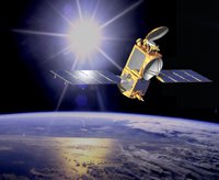
The Ocean Surface Topography Mission on the Jason-2 satellite (OSTM/Jason-2) is a follow-on to the Jason mission. OSTM is a joint effort by four international partners to measure sea surface height by using a radar altimeter mounted on the low-earth orbiting satellite, Jason-2. The four mission partners are:
- National Oceanic and Atmospheric Administration (NOAA)
- National Aeronautics and Space Administration (NASA)
- France's Centre National d'Etudes Spatiales (CNES)
- European Meteorological Satellite Organization (EUMETSAT)
OSTM/Jason-2 was launched in June 2008.
This satellite altimetry mission provides sea surface height data for observing ocean circulation, climate change, sea-level rise, and other dynamic ocean processes. OSTM/Jason-2 is a follow-on to the TOPEX/Poseidon and Jason-1 missions which have been instrumental in meeting both research and operational needs for ocean modeling, forecasting El Nino/La Nina and other climate events, hurricane intensity prediction, and many practical applications.