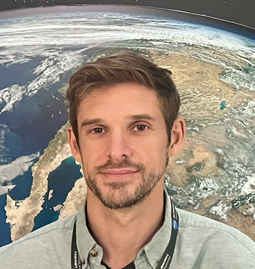
Dr. Brett Buzzanga

Address:
4800 Oak Grove Drive
M/S 300-323
Pasadena, CA 91109Email:
Click hereMember of:
Sea Level And IceJIFRESSE Research Associate
Biography
Dr. Buzzanga is an Earth Scientist focused on the coast. He works primarily with satellite data to better understand sea-level dynamics. Using radar and laser altimeters, he measures oceanic changes, and with InSAR (Interferometric Synthetic Aperture Radar), he studies coastal vertical land motion, which can exacerbate the impacts of sea-level rise. More broadly, he's interested in the interplay between science and society, particularly how human actions have shaped and continue to influence the climate—and how the climate, in turn, shapes human behavior. To explore this, he uses large-scale modeling experiments to assess the impacts of greenhouse gas emissions and investigate the opportunities and risks of climate interventions.
Education
- Ph. D. Oceanography, Old Dominion University, 2021
- M.S. Earth Science, Old Dominion University, 2017
- A.S. Math and Science, Brookdale Community College, 2013
- B.A. Political Theory, Rutgers University, 2011
Professional Experience
- Assistant Researcher, JIFRESSE, University of California Los Angeles, (2024-present)
- Postdoctoral Scholar, Jet Propulsion Laboratory (2021 – 2024)
- Research Assistant, Old Dominion University (2014 – 2021)
Research Interests
- Sea-level change
- InSAR remote sensing
- Coastal impacts
- Global environmental change
Selected Awards
- NASA Sea Level Change Team (2024-2028)
- ICESat-2 Science Team (2023-2026)
- NISAR Team Award (Tropospheric Model Downselection)
Selected Publications
- Buzzanga, B., Hamlington, B., Fasullo, J., Landerer, F., and Peidou, A. (2025) Interdecadal variability of terrestrial water storage since 2003. Nature Communications Earth & Environment https://doi.org/10.1038/s43247-025-02203-6
- Buzzanga, B., Hamlington, B., Bekaert, D., Pavelsky, T., Handwerger, A., Bonnema, M., & Lee, C. (2025). Monitoring water from space: An illustration in Death Valley, California. Geophysical Research Letters, 52, e2024GL110250. https://doi.org/10.1029/2024GL110250
- Buzzanga, B., Bekaert, D., Hamlington, B., Kopp, R., Govorcin, M., and Miller, K. (2023). Widespread Subsidence and Localized Uplift in the NYC Metropolitan Area. Science Advances https://doi.org/10.1126/sciadv.adi8259